Biparjoy has intensified further and is expected to make landfall along the south-southeastern coast of Sindh and the adjoining Gujarat coast in India.
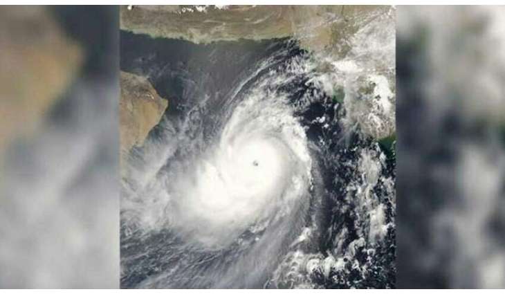
KARACHI: (UrduPoint/Pakistan Point News-June 12th, 2023) The meteorological department's cyclone warning center has reported that the extremely severe cyclone Biparjoy, previously categorized as a very severe cyclonic storm, has shifted its trajectory and is currently positioned approximately 600km south of Karachi in the east-central Arabian Sea.
Biparjoy has intensified further and is expected to make landfall along the south-southeastern coast of Sindh and the adjoining Gujarat coast in India. The exact location of the landfall will become clearer in the upcoming days.
Over the past 12 hours, the cyclone has moved northward and is now situated near Latitude 19.5°N and Longitude 67.7°E, maintaining a distance of approximately 600km south of Karachi, 580km south of Thatta, and 710km southeast of Ormara.
With maximum sustained surface winds of 160-180 Km/hour and gusts reaching up to 200 Km/hour near the center, the sea conditions around the cyclone are extremely rough, with wave heights peaking at 35-40 feet.
According to the meteorological office, based on the current upper-level steering winds, Cyclone Biparjoy is expected to continue its northward trajectory until the morning of June 14. Afterward, it will recurve northeastward and cross between Keti Bandar in Southeast Sindh and the Indian coast of Gujarat on the afternoon of June 15 as a Very Severe Cyclonic Storm (VSCS).
The approaching cyclone is likely to bring widespread wind, dust, thunderstorms, and heavy rainfall to several districts, including Thatta, Sujawal, Badin, Tharparker, Mirpurkhas, and Umerkot, from June 13 to June 17. The rainfall may be accompanied by squally winds of 80-100 Km/hour, gusting up to 120 Km/hour in some areas.
In Karachi, Hyderabad, Tando Muhammad Khan, Tando Allayar, Shaheed Benazirabad, and Sanghar districts, there is a possibility of dust, thunderstorms, and rainfall with a few heavy downpours, along with squally winds of 60-80 Km/hour from June 14 to June 16.
It is important to note that the high-intensity winds associated with the cyclone could potentially cause damage to vulnerable structures, including solar panels.
A storm surge of 3-3.5 meters (8-12 feet) is anticipated at the point of landfall, particularly around Keti Bandar, which may result in the inundation of low-lying settlements.
As a precautionary measure, fishermen are advised to avoid venturing into the open sea until the system has passed, as the conditions in the Arabian Sea are expected to become extremely rough with high tides along the coast.