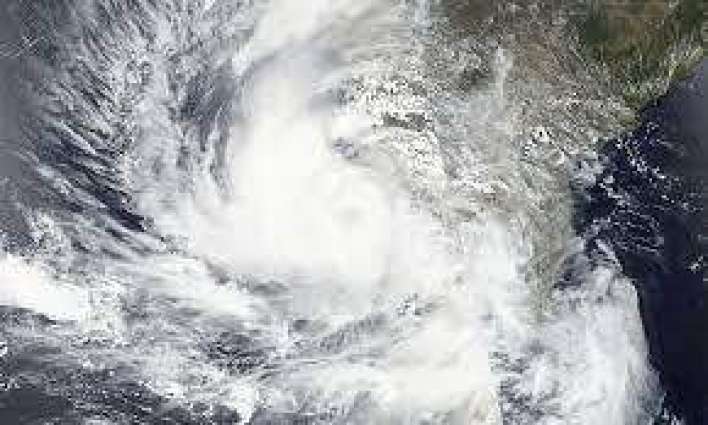
Over the past six hours, it has moved in a northerly direction and is currently located approximately 910 kilometers south of Karachi.
KARACHI: (UrduPoint/Pakistan Point News-June 10th, 2023) A highly severe cyclonic storm named Biparjoy was observed over the east central Arabian Sea, the Meteorological Office said on Saturday.
Over the past six hours, it has moved in a northerly direction and is currently located approximately 910 kilometers south of Karachi. Weather reports suggest that the storm is expected to gradually intensify and continue its north-northeastward movement over the next 24 hours, followed by a gradual shift to a north-northwestward trajectory in the subsequent three days.
With its projected path toward the north-northeast, Sindh-Makran coast should anticipate rain, thunderstorms, heavy precipitation, and squally winds starting from the night of June 13 or the morning of June 14. The Pakistan Meteorological Department (PMD) issued an update on Saturday, stating that the very severe cyclonic storm in the east-central Arabian Sea has maintained its intensity and has moved northeastward in the past 12 hours. The PMD report reveals that the storm is currently positioned approximately 910 kilometers south of Karachi, 890 kilometers south of Thatta, and 990 kilometers southeast of Ormara.
The system's center is experiencing maximum sustained surface winds of 120-130 km/h, with gusts reaching 150 km/h. The favorable environmental conditions are expected to support the further intensification of the storm. However, due to variations in upper-level steering winds, there is still some uncertainty among global models regarding the forecasted track of Cyclone Biparjoy, with some models suggesting a landfall on the Oman-Makran coast while others indicate a trajectory towards the Gujarat-Sindh coast.
Given this uncertainty, it is predicted that the system will continue to move north/northeastward over the next 18-24 hours before slightly curving to the north-northwest. The cyclone warning center in Karachi, operated by the PMD, is closely monitoring the system and will provide updates accordingly.
Fishermen have been advised to avoid venturing into the open sea from Monday, June 12, until the storm has passed, as the Arabian Sea conditions may become extremely rough with high tides along the coast. Beginning Tuesday night or Wednesday morning, the Sindh-Makran coast should expect rain, thunderstorms, heavy precipitation, and strong winds. The high-intensity winds have the potential to cause damage to structures that are not firmly secured.
Sea conditions near the system center are currently very rough, with maximum wave heights reaching 25-28 feet. According to the Indian weather department's update on Saturday morning, Cyclone Biparjoy is centered approximately 700 kilometers west of Goa, 630 kilometers west-southwest of Mumbai, 620 kilometers south-southwest of Porbandar, and 930 kilometers south of Karachi.